From trekking the challenging trails of Yubeng-Meili Snow Mountain to a more leisurely walk on Cangshan Mountain of Dali or hiking through the slightly demanding Tiger Leaping Gorge, the 7 best Yunnan hikes suit every level of fitness and expertise.
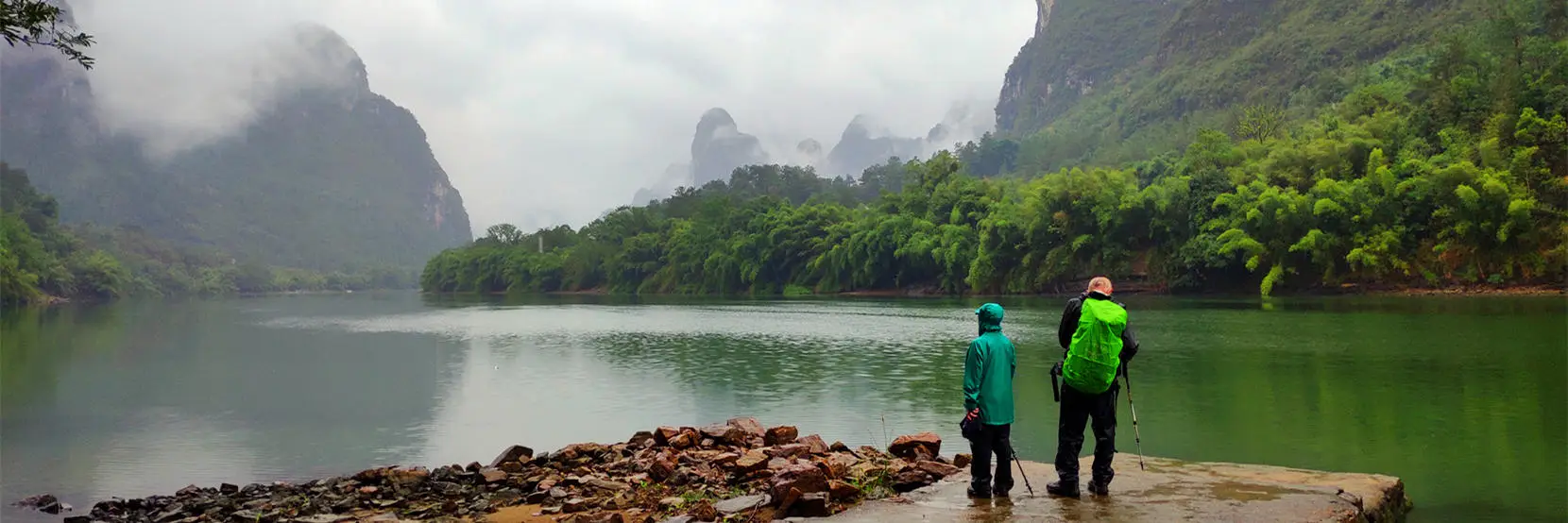
Why Hiking in Yunnan - A Paradise for Outdoor Adventures
Uncover the beauty of diverse landscapes: From tropical rainforests to frigid snow-capped mountains and glaciers, from canyon to highland, from wild elephant valleys to the habitat of the Yunnan golden monkey, Yunnan is China's most biodiverse province. Gaoligong Mountain is even a UNESCO-certified "World Species Gene Bank." Hiking in Yunnan is like walking through a "geological and geomorphological museum."
World-class hiking routes: Yunnan boasts many internationally recognized classic hiking routes. The highroad of Tiger Leaping Gorge is one of the world's top ten classic hikes. Hidden in the sacred site of Tibetan Buddhism, Meili Snow Mountain-Yubeng is another iconic trekking trail in Yunnan.
Ancient caravan routes: Besides this magnificent scenery, also give your legs and cameras a workout as you hike the Ancient Tea Horse Road and the Southern Silk Road, delving into ethnic villages and Himalayan foothills.Pleasant weather: Kunming and Dali enjoy spring-like weather year-round. At higher altitudes (such as Shangri-La), the average temperature for hiking in summer (June-August) is between 15-25℃.Tiger Leaping Gorge Hike
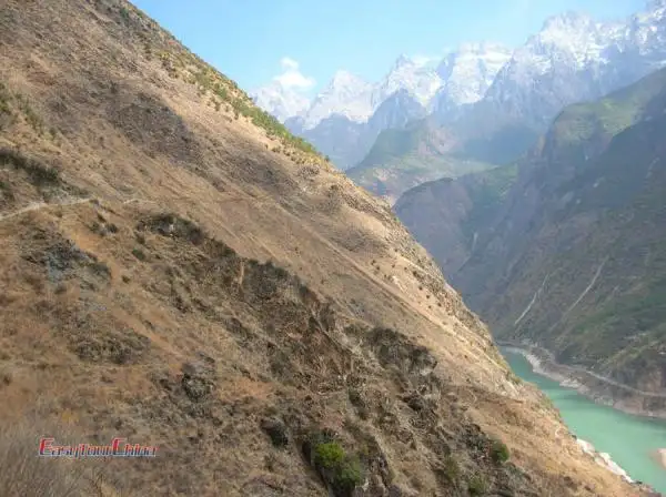
Here, the mighty Yangtze River breaks through barriers and obstacles, with surging waves churning and surging in the deep gorges. Tiger Leaping Gorge is widely known as one of the best hiking destinations in China and even in the world. This perilous and magnificent canyon, guarded by Haba Snow Mountain and Jade Dragon Snow Mountain, boasts the greatest drop in the world.
The hiking route through Tiger Leaping Gorge can be combined in various ways based on individual fitness and preferences. The starting points are basically the Qiaotou and Daju. The canyon is about 20 kilometers long, with the highest altitude difference between the mountains reaching up to 3,900 meters. It is divided into Upper Tiger Leaping Gorge, Middle Tiger Leaping Gorge, and Lower Tiger Leaping Gorge, with a total of 18 dangerous rapids, and the narrowest part of the river is only about 20 meters. No matter which end of Tiger Leaping Gorge you start hiking from, you can complete the journey within two to three days.
Recommended Routes:
Tiger Leaping Gorge highroad Loop: Qiaotou → Changsheng Village → Zhongluoyu → 28 Bends → Ganyanfang → Liangjiaren → Bendicwan → Teacher Zhang's House → Middle Gorge Riverside → Walnut Garden (via highway) → Upper Tiger Leaping Gorge (via highway) → Qiaotou, approximately 26-35 km, 2 days hiking.
Tiger Leaping Gorge Traverse Route: Qiaotou → Changsheng Village → Zhongluoyu → 28 Bends → Ganyanfang → Liangjiaren → Bendicwan → Teacher Zhang's House → Middle Gorge Riverside → Walnut Garden → Huashiban → Old Ferry Crossing → Daju, approximately 22-25 km, 2 days hiking.
>> Recommended China hiking tours:
Meili Snow Mountain Trekking

The trekking route of Yunnan Meili Snow Mountain for pilgrimages can be roughly divided into inner loop (circling around Yubeng) and outer loop. Additionally, there is also the trekking route on the northern slope of Meili Snow Mountain.
Trekking on the northern slope of Meili Snow Mountain, starting from the foot camp, you will delve into the original dense forest, traverse the winding river valleys, the ice rivers, and cross the gray and desolate mountains. The cumulative ascent height of the entire journey will reach 4,650 meters, and the highest point of the Yunnan-Tibet Pass is as high as 5,200 meters.
The outer loop hiking of Meili Snow Mountain is even more challenging, with most of the trails located within the Chayu County, Tibet. Following the footsteps of devout Tibet Buddhist believers, walk around the sacred mountain. During this enlightening and spiritual hiking journey, take in the views of the primitive forest, canyon, and snow-capped mountains of the UNESCO-listed Three Parallel Rivers of Yunnan Protected Areas.
Recommended Meili Snow Mountain North Slope Route: Yagong Village → Pojun Camp → Ciding Pass → Dianzang Pass → Yagong Village, approximately 45-50 km, 4-5 days trekking.
Recommended Meili Snow Mountain Outer Loop Route: Yangzan → Yongjiu → Yongshitong → Duokelaka Pass → Zhashutong → Maibo → Abing Village → Quzhu → Chawalong → Gebu → Dagula → Laide Bridge → Laide Village → Shuola Pass → Dulongtang → Meili Water, approximately 150 km, 10-12 days trekking.
>> Recommended Yunnan tours: 9 Days ShangriLa, Meili Snow Mountain & Yubeng Village Trek TourYubeng Village Trek

Also one of the best hiking trails in China, Yubeng Village is located on the eastern slope of Meili Snow Mountain. Surrounded by mountains on all sides, it is sparsely populated, with only about 20 households. There are two ancient trails: one leading towards Xidang and the other towards Ninong Grand Canyon. Hiking to Yubeng generally starts from Xidang and exits through Ninong Grand Canyon.
Yubeng Village is divided into upper and lower villages. The upper village leads to the Sino-Japanese joint mountaineering base camp for climbing Kawagebo, while the lower village leads to Yubeng Sacred Waterfall.
Initially, access to Yubeng Village was only possible on foot or horseback, with accommodation in wooden huts and instant noodles as the staple food. Now, with the increasing number of hikers, guesthouses and even some luxury boutique hotels have sprung up. Yubeng Village is gradually becoming a major trekking base camp for Meili Snow Mountain area.>> View the classic 3-4 day Yubeng trekking routeOr explore the Meili Snow Mountain inner loop route:
Feilai Temple → Lancang River Bridge (the one open to traffic) → Lengshanlin Temple → Yongzong → Bajiu Cave → Xidang Village → Xidang Hot Spring → Upper Nazongla Pass → Upper Yubeng Village → Lower Yubeng Village → Sacred Waterfall River → Lotus Cave (Wujian Zen Cave) → Sacred Waterfall → Lower Yubeng Village → Upper Yubeng Village → Upper Nazongla Pass → Xidang Village → Yongzong → Mingyong Village → Glacier → Prince Temple (Guimian Sacred Palace) → Lotus Temple (Guidui) → Mingyong Village → Deqin County
Haba Snow Mountain Hike
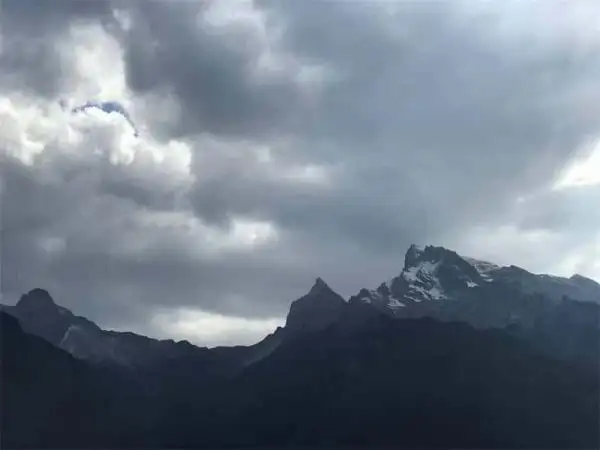
Haba Snow Mountain, with an altitude of only 5396 meters, has become a popular choice for mountaineering in Yunnan in recent years. Beginners often consider it their first snow mountain climb in China. Climbers don't need advanced skills; good hiking experience, ample physical strength, an experienced guide, and non-slip, waterproof, and warm gear are all that's needed to successfully reach the summit.
Trekking up Haba Snow Mountain is a journey from lush, dense forests to mist-shrouded peaks, and finally to snow-capped slopes. Upon reaching the summit, you'll be greeted by breathtaking panoramic views of Jade Dragon Snow Mountain, Meili Snow Mountain, and the three sacred mountains of Yading.
Haba Snow Mountain's low latitude also makes it possible for winter hiking in Yunnan.West Slope Traditional Route
First ascended in 1995. The climb begins on the west side and ends with a descent to the northwest ridge.Northwest Ridge Route
Begin the climb along the valley north of the summit, proceeding up the right-hand slope. This will be the most difficult section, a steep scree slope (with the possibility of landslides). Once on the ridge, ascend along it and establish Camp 1 near the snow line (4900m). Continue along the ridge to reach the summit. This route is quite long, and traversing the valley floor in winter with heavy snowfall can be extremely difficult (dense rhododendron thickets hide beneath the deep snow). Overall, the route is well-defined and easy to navigate, and there are multiple successful summit attempts using this route.
Shangri-La Niru Trekking
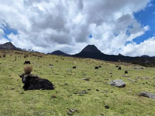
It is one of the hidden Yunnan hikes. Niru is a mysterious place almost isolated from the world, with nearly a thousand square kilometers of primeval forest, rushing streams and rapids, meadows and travertine terraces, and some Tibetan mountain villages hidden deep in the dense forest.From an altitude of 2500 meters to 3800 meters, the winding trail will take you through alternating periods of warmth and cold. Trekking through dense forests of fir, larch, and oak, covered in thick lichen and moss, you will often be separated by rushing streams, while meadows and travertine terraces flow gently from the mountains. At the Seven-Colored Waterfall, you can see water cascading down the pristine tundra. Although there are no snow-capped mountains, wild rhododendrons bloom profusely throughout the mountains in summer.
Recommended Route: Luoji Township → Hongxing Village → Niru Village → Gaoshan Pass → Shudu Lake → Shudu Lake Scenic Area
Cangshan Mountain Hiking
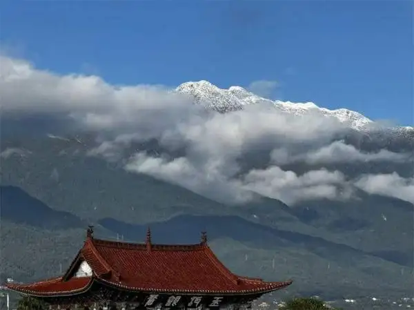
Among all the hikes in Yunnan, Cangshan Mountain is one of the easiest, yet featuring scenic trails. There are several routes for hiking Cangshan Mountain, here we recommend a classic.
First, take a bus from Xiaguan in Dali City to Yangbi. Get off at the Ziyang Shangcun intersection and hike 9 kilometers to the village. Then hike another two and a half hours to Muguashu Village for the night. If you want more time for the next day, you can continue hiking to Dapingdi Village for another night.
The next day, start climbing up the ridge behind Baishi Temple. The slope is around 50 degrees. This section is quite strenuous, especially if you are carrying a heavy load. At an altitude of 2840 meters, there is a fork in the road with two clearly marked paths on either side. The correct route is to continue climbing along the middle ridge. At this point, you will feel increasingly uncomfortable, but the view will become increasingly expansive. After about an hour, you will reach the snow line. The most difficult two hours of climbing will take you to the north pass of Baiyun Peak. From there, it's a 15-minute hike south along the ridge to the summit of Baiyun Peak. If you start at 7:00 AM, you will reach the pass and summit around 1:00 PM.
When crossing the pass and heading east on the slope, never follow the ravine, as you will encounter a large, dense forest of arrow bamboo. Even more dangerous is that once you enter the Jinxi ravine, you will encounter increasingly treacherous drops as you descend. Remember to always stay on the trail along the ridge. It takes about 5 to 6 hours to reach Heyang Village in Yinqiao Township at the foot of the mountain, and you should be able to reach the roadside before dark.
Recommended Route: Ziyang Shangcun → Mugua Tree → Erpingdi → Dapingdi → Baishi Temple → North Ridge Edge → Ridge Line → Baiyun Peak Valley Stream → West Ridge → North Side Pass of Baiyun Peak → East Ridge → Heyang VillageJade Dragon Snow Mountain Hiking
Hike Jade Dragon Snow Mountain to retrace the Ancient Tea Horse Road and see its rugged peaks, magnificent glaciers, and primeval forests.
A classic Jade Dragon Snow Mountain trail:
From Lijiang Old Town, take a bus/private transfer to Wenhai Village, at an altitude of 3150 meters. Wenhai was once a vital stop on the Ancient Tea Horse Road and is the closest village to Jade Dragon Snow Mountain.Begin your hike from Wenhai. The trail winds through primeval forests, and after about an hour, you'll reach the spruce forest, known as Jade Dragon Snow Mountain's natural oxygen bar. The spruce forest is evergreen, and from April to June, hikers can see a sea of rhododendrons. This section is not technically difficult, but it's easy to get lost.
From the spruce forest, the hike takes about 90 minutes to reach the snow-capped meadow at an altitude of 4250 meters. This is actually a natural pasture, with abundant wildflowers in summer and snow-covered landscapes in winter.
Continue hiking for about 2 hours, mostly on steep slopes of 60-75 degrees, to reach the first peak of Jade Dragon Snow Mountain, at an altitude of approximately 4642 meters. It is a peak on the south side of Jade Dragon Snow Mountain, one of the thirteen peaks of Jade Dragon Snow Mountain. Looking around, you can see the majestic, snow-white Fanzidou Peak, Shangri-La, the First Bend of the Yangtze River, Lijiang Old Town, Shuhe Ancient Town, and Baisha Ancient Town.
After successfully reaching the summit, rest for a while, and then hike down the mountain, which takes about 2-3 hours.